Google can now say its Street View maps service spans across every one of the world’s continents.
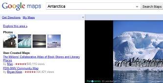
Very few people will ever get to see what Antarctica looks like in person, but that didn’t keep Google’s Street View mission from going all the way down to the South Pole.
Street View was originally implemented so people could zoom in to specific locations they were traveling to in order to see what’s around the area.
But that’s obviously not an issue in Antarctica, so for Google this move is more about providing a more comprehensive view of the entire world, just for the sake of documenting it.
“We often consider Street View to be the last zoom layer on the map, and a way to show you what a place looks like as if you were there in person, whether you’re checking out a coffee shop across town or planning a vacation across the globe,” said Google Maps engineering VP Brian McClendon.
Antarctica’s Street View is a bit different than the rest of the system, because the continent doesn’t really have standard street addresses. Instead, it just provides clear images from the ground of various mountains and landmarks.
The only thing to wait for now is a class-action lawsuit from all the penguins who now feel their privacy has been violated.