An explanation has been found for why one widely-used climate record shows a different warming trend to others.

The satellite temperature record put together by the University of Alabama in Huntsville in 1989 – often cited by climate change skeptics to cast doubt on climate change models – contains a data calibration error, say two University of Washington scientists.
Graduate student Stephen Po-Chedley and professor Qiang Fu examined the record from the researchers in Alabama, along with satellite temperature records that were subsequently developed by the National Oceanic and Atmospheric Administration and Remote Sensing Systems.
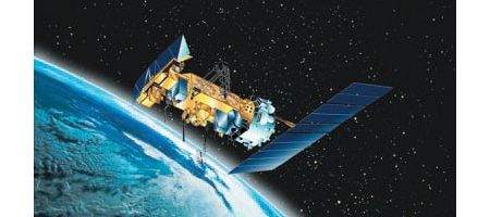
And, they say, the way the Alabama scientists handled data from NOAA-9, a satellite that collected temperature data in the mid-1980s, needs adjusting.
“There’s been a debate for many, many years about the different results but we didn’t know which had a problem,” says Fu. “This discovery reduces uncertainty, which is very important.”
To come up with the correction, Po-Chedley and Fu closely examined the way the three teams interpreted readings from NOAA-9 and compared it to data collected from weather balloons about the temperature of the troposphere.
They found that the Alabama research incorrectly factored in the changing temperature of the NOAA-9 satellite itself and devised a method to estimate the impact on the Alabama trend.
When the team applied their correction to the Alabama-Huntsville climate record for a UW-derived tropospheric temperature measurement, it effectively eliminated differences with the other studies.
With the adjustment, the Alabama-Huntsville record shows 0.21 F warming per decade in the tropics since 1979, instead of its previous finding of 0.13 F warming. Surface measurements show the temperature of Earth in the tropics has increased by about 0.21 F per decade.
The Remote Sensing Systems and NOAA reports continue to reflect warming of the troposphere that’s close to the surface measurements, with warming of 0.26 F per decade and 0.33 F respectively.
The discrepancy arises because the records are a composite of data from over a dozen weather satellites launched since late 1978 that use microwaves to determine atmospheric temperature.
However, stitching together data collected by those satellites to discover how the climate has changed over time is a complicated matter. Scientists must take into account the satellite’s drift over time and differences in the instruments used to measure atmospheric temperature on board each satellite.
The readjustment doesn’t resolve all the discrepancies among the records, and researchers will continue to look at ways to reconcile those conflicts.
“It will be interesting to see how these differences are resolved in the coming years,” says Po-Chedley.


